Town Master Plan
GMADA Regional Plan (Mohali / SAS Nagar)
Approximate map coordinates: 30.7046, 76.7179
This town/region is covered by a GMADA master plan. The documents below — the actual zoning, land-use, and planning detail — are hosted on and served directly from gmada.gov.in.
Proposed Land Use Plan
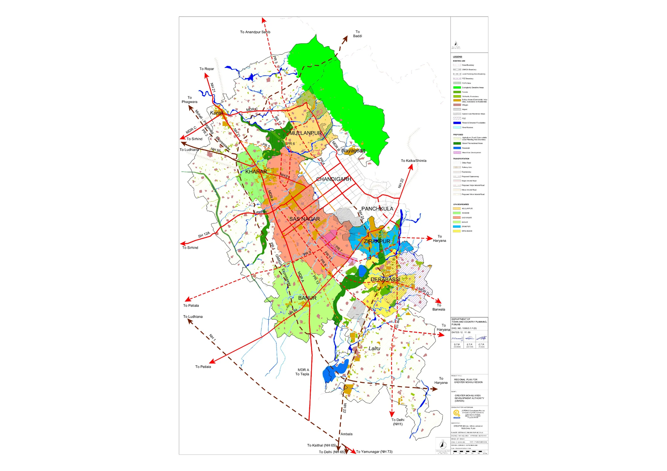
Extracted directly from GMADA's own proposed land-use drawing for GMADA Regional Plan (Mohali / SAS Nagar) — click to open full size. Colours follow the plan's own legend (residential, industry, institutional, green space, and so on); see the "Reading the Plan" section below for what each one means.
What This Regional Plan Covers
Unlike the other pages on this site, this one isn't a single town's master plan — it's the umbrella Regional Plan for the entire Greater Mohali Region (GMR), the document that ties together the six original Local Planning Areas GMADA was set up to cover: S.A.S. Nagar, Zirakpur, Kharar, Mullanpur, Banur, and Dera Bassi. It was prepared by JURONG Consultants Pte Ltd and is dated 12 November 2008, under the title "Regional Plan for Greater Mohali Region."
One document is on file here: the regional plan drawing itself, downloadable from this page. GMADA's own listing also names a separate Regional Plan Report, but that link currently returns an error on GMADA's own site (confirmed directly) rather than a working document — this page will be updated if that changes.
Region-Wide Land Use
Per the regional plan's own land-use distribution table (as cited in the individual Zirakpur master plan report, since the regional report itself isn't currently retrievable), the GMR's roughly 119,036 hectares break down as: 35.9% urbanizable area, 21% agriculture outside the local planning areas, 15.5% agriculture within them, 10.3% forests, 4.1% transportation, 3.8% rural settlements, 3.7% recreational, 2.4% water bodies, 2.1% industrial, and 1.1% restricted development zone.
The drawing itself shows all six LPAs at once, colour-coded, with the region's expressway and PR-numbered road network connecting them to Chandigarh, Panchkula, Patiala, Ludhiana, Ambala, Anandpur Sahib, and Baddi.
Scale and Long-Term Vision
The Greater Mohali Region spans roughly 1,190 square kilometres and around 472 villages across its constituent local planning areas, planned around a long-term population target in the range of 4.5 million people. Individual town master plans — for Banur, Dera Bassi, Kharar, Mullanpur, S.A.S. Nagar, and Zirakpur — were each prepared as a more detailed follow-on to this regional framework, which is why several of them reference this same regional plan and its land-use table directly.
Reading the Plan
Because this drawing covers the whole region rather than one town, it's best used to see how the individual town plans on this site relate to each other geographically — for parcel-level detail within any single LPA, the individual town's own master plan page will have the finer-grained drawing. As with every document on this portal, treat this as a reference copy of GMADA's planning intent rather than a live record — always confirm the current, in-force version directly with GMADA before relying on it for a specific decision.