Town Master Plan
Lalru
Approximate map coordinates: 30.4937, 76.8006
This town/region is covered by a GMADA master plan. The documents below — the actual zoning, land-use, and planning detail — are hosted on and served directly from gmada.gov.in.
Proposed Land Use Plan
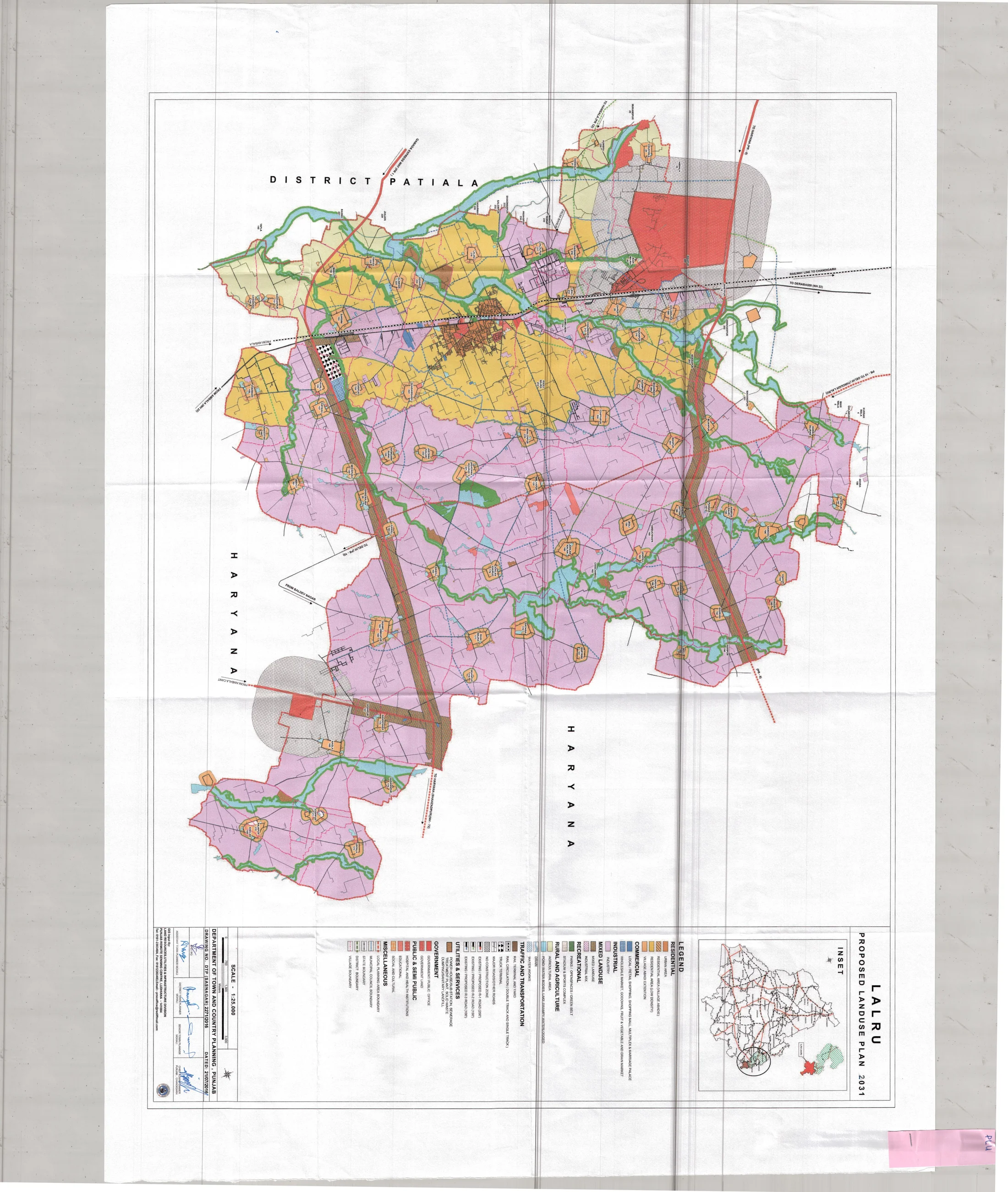
Extracted directly from GMADA's own proposed land-use drawing for Lalru — click to open full size. Colours follow the plan's own legend (residential, industry, institutional, green space, and so on); see the "Reading the Plan" section below for what each one means.
What This Land Use Plan Covers
Lalru's plan covers two towns — Lalru and Dapper — plus 75 surrounding villages, spread across 22,429 hectares (55,399 acres), with a population of 112,462 recorded in the 2011 census. The stated vision is to develop Lalru into "a world class and premium industrial hub" capable of accommodating both small and major industrial units.
The town sits about 35km from Chandigarh on NH-22, the Chandigarh–Ambala national highway, near Dera Bassi, Banur, and Zirakpur. It's also known locally for hosting one of the region's biggest chilli markets, alongside established industries including Agro-duch, Nutrica, Rana, Polycot, and Punjab Chemicals.
Industry and Infrastructure
Part of the planning area touches an already-declared Free Enterprise Zone (FEZ) to the northeast. NH-22, NH-72, and the Chandigarh–Ambala railway line all run through the town, and the wider GMADA Regional Plan (notified 27 February 2009) adds planned regional links — the PR-1 Expressway, PR-8, and PR-10 — connecting Lalru to the surrounding region.
Geography and a Notable Land Use
The Ghaggar River forms the planning area's western boundary, with numerous seasonal choes (local streams) crossing the region — dry outside the monsoon but prone to swelling during it, which the plan treats as a flood-protection priority for groundwater recharge. One specific existing land use worth noting: an ammunition dump falls within the villages of Dapper, Bair Majra, and Nagla.
Lalru's plan was prepared after master plans for S.A.S. Nagar, Zirakpur, Dera Bassi, Kharar, Banur, and New Chandigarh were already in place, as part of GMADA's effort to bring the same orderly planning to villages around Lalru that had been growing without one.
Reading the Plan
Two documents are on file for Lalru — this master plan report and the proposed land-use drawing — both downloadable from this page. As with every document on this portal, treat this as a reference copy of GMADA's planning intent rather than a live record — always confirm the current, in-force version directly with GMADA before relying on it for a specific parcel or transaction.