Town Master Plan
New Chandigarh (2008-2031)
Approximate map coordinates: 30.8089, 76.7268
This town/region is covered by a GMADA master plan. The documents below — the actual zoning, land-use, and planning detail — are hosted on and served directly from gmada.gov.in.
Proposed Land Use Plan
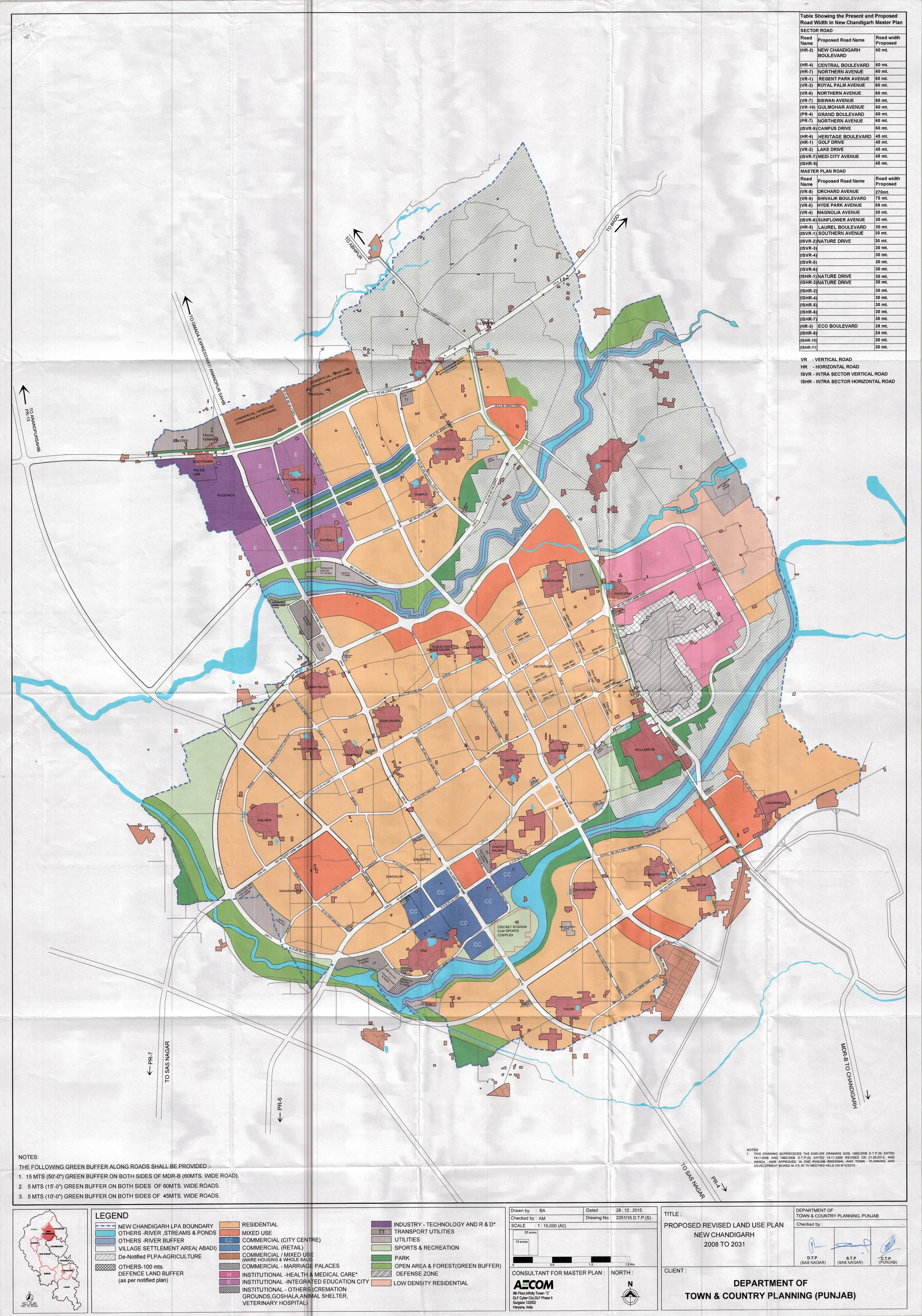
Extracted directly from GMADA's own proposed land-use drawing for New Chandigarh (2008-2031) — click to open full size. Colours follow the plan's own legend (residential, industry, institutional, green space, and so on); see the "Reading the Plan" section below for what each one means.
Real Master Plan Documents
Master Plan
13.1 MB · PDFZonal Plan
2.4 MB · PDFMaster Plan Report
18016 KB · PDFRevenue Master Plan
2223 KB · PDFWhat This Zonal Plan Covers
New Chandigarh is built on the same Local Planning Area GMADA originally studied as Mullanpur under its 2008–2031 regional master planning exercise. This page's zonal plan is a more detailed, plot-level drawing than a town-wide master plan — it was approved by the Punjab Regional and Town Planning and Development Board at its 30th meeting, held on 9 December 2015.
Detailed Zoning Categories
Because this is a zonal plan rather than a broad master plan, its land-use categories go well beyond the usual residential/industrial/institutional split: it separately zones commercial city-centre and retail areas, mixed-use warehousing and wholesale land, an integrated education city, health and medical care institutions, technology and R&D industry, and low-density residential areas, alongside village settlement (abadi) zones mapped from 2010 satellite imagery.
Notably, the plan also marks a defined Defence Zone and a matching Defence Land Buffer — a real, specific constraint on development in parts of the area, not just a generic land-use label.
Plot-Level Detail
Unlike the region's town-wide master plans, this drawing marks individual facilities by name and location — schools (nursery, primary, and higher secondary), police posts, dispensaries, parks, and EWS (economically weaker section) housing blocks — referenced against khasra (revenue survey) numbers, which is the level of detail a developer or plot owner would actually need to check a specific parcel's designation.
Reading the Plan
Four documents are on file here: the original master plan, this zonal plan, a fuller master plan report, and a separate revenue master plan — all downloadable from this page. As with every document on this portal, treat this as a reference copy of GMADA's planning intent rather than a live record — always confirm the current, in-force version and any amendments directly with GMADA before relying on it for a specific parcel or transaction.